
High-res satellite monitoring and field verification for protecting one of the last forests of the Tapanuli Orangutan
Partners: Yayasan Ekosistem Lestari (YEL) and Airbus Foundation
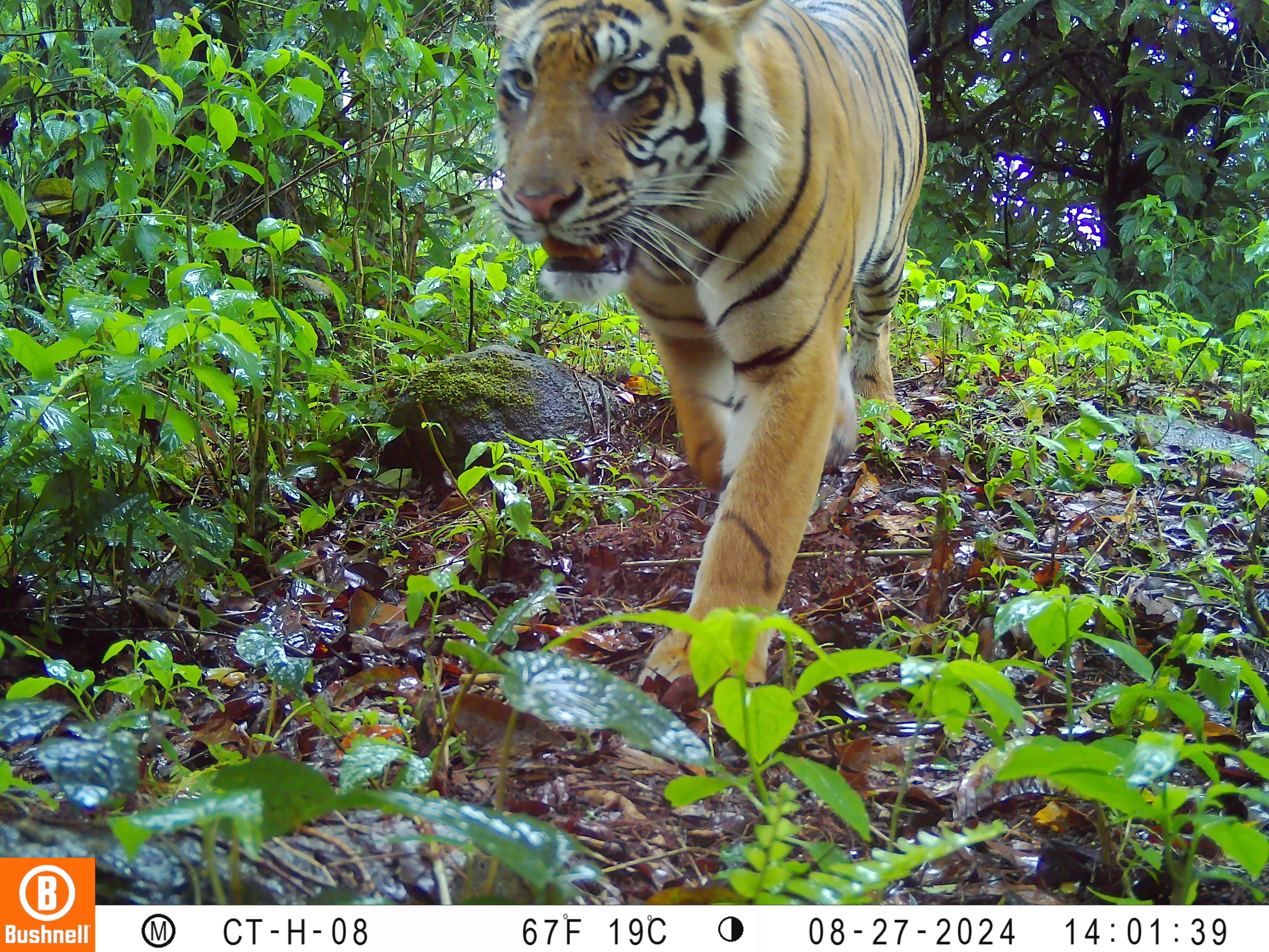
Key Species: Tapanuli orangutan, Sumatran tiger, Sunda pangolin, siamang, agile gibbon, helmeted hornbill, rhinoceros hornbill, lagan bras
Key Ecosystems: Upland rainforest
2026 Award Winner
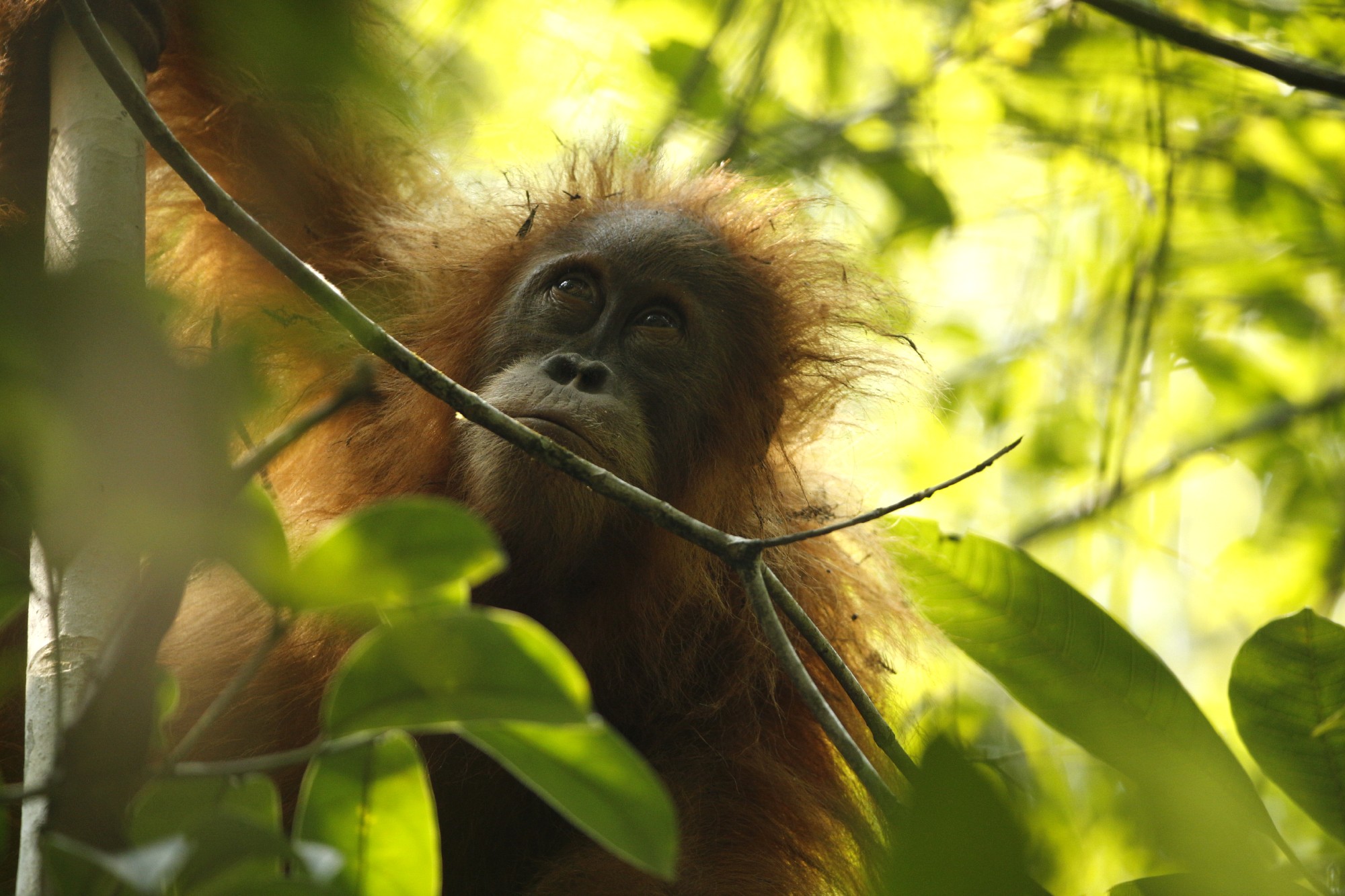
Within the rugged highlands of North Sumatra lies the only known home of the Tapanuli orangutan (Pongo tapanuliensis), the world's rarest great ape. Recognised as a distinct species in 2017, the entire population is restricted to the Batang Toru Ecosystem, making the protection of this landscape essential to its survival.
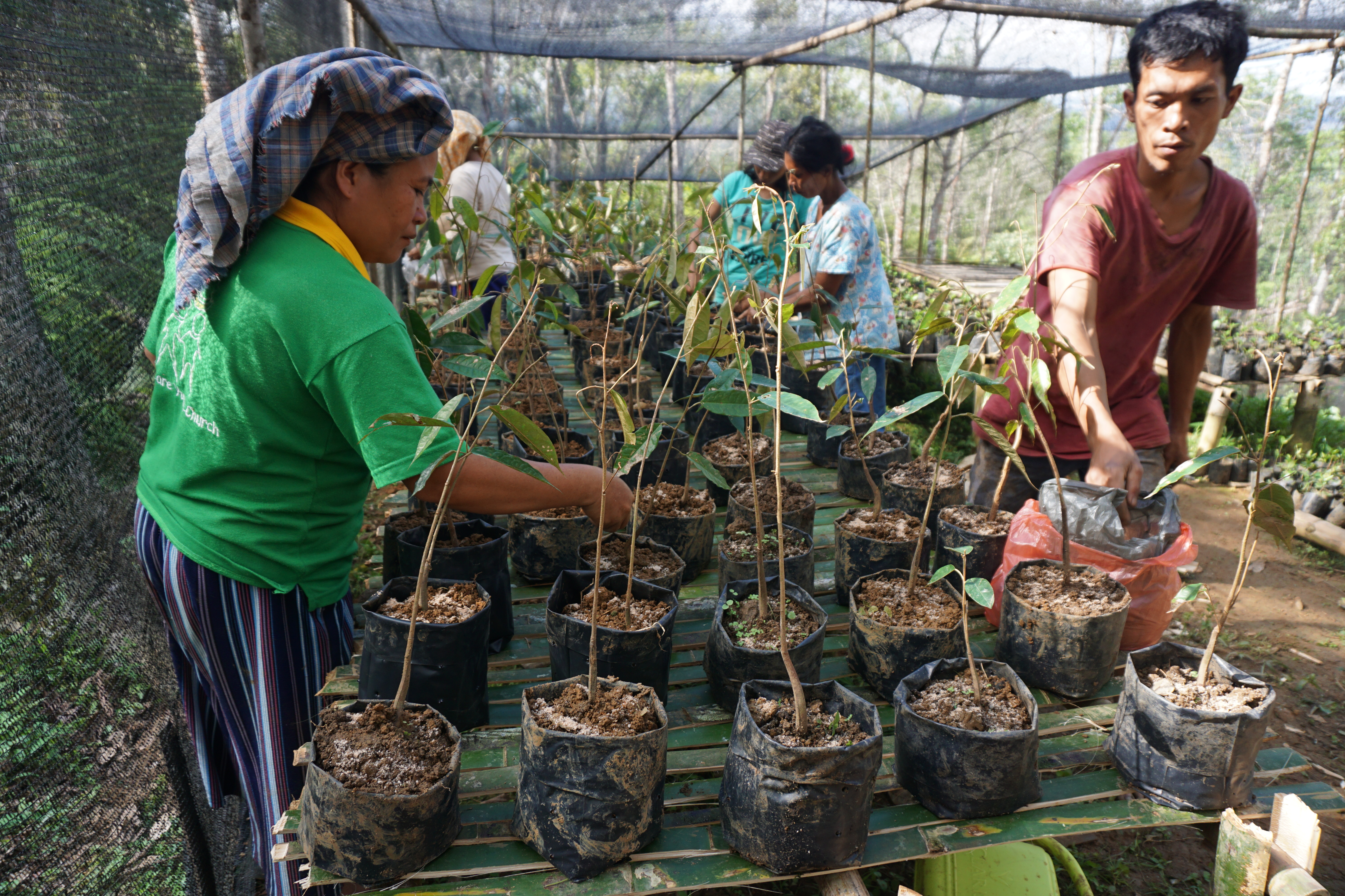
Batang Toru also supports a rich diversity of wildlife, including tigers, pangolins, gibbons and hornbills, as well as rare upland plant species. The ecosystem also provides vital benefits to surrounding communities, supplying clean water, regulating the climate and sustaining local livelihoods. Yayasan Ekosistem Lestari (YEL) has worked in the Batang Toru Ecosystem for many years through habitat protection, biodiversity monitoring, community engagement, and conservation partnerships to secure the future of the Tapanuli orangutan.
Scientists warn that even small increases in mortality or habitat loss could push the species towards extinction because females reproduce exceptionally slowly, giving birth only once every seven to nine years. Whilst conservation efforts and community engagement have improved protection of the species and its habitat, the Tapanuli orangutan remains highly vulnerable.
Protecting a fragile stronghold
Classified as Critically Endangered by the IUCN, the Tapanuli orangutan depends on extensive, connected forest habitat for breeding, foraging and long-term survival. In November 2025, this fragile stronghold suffered a devastating blow when extreme flooding and landslides triggered what conservationists described as an “extinction-level disturbance”. The disaster destroyed over 6,000 hectares of intact forest and is estimated to have killed around 11% of the Tapanuli orangutan population, while also claiming the lives of more than 1,000 people.
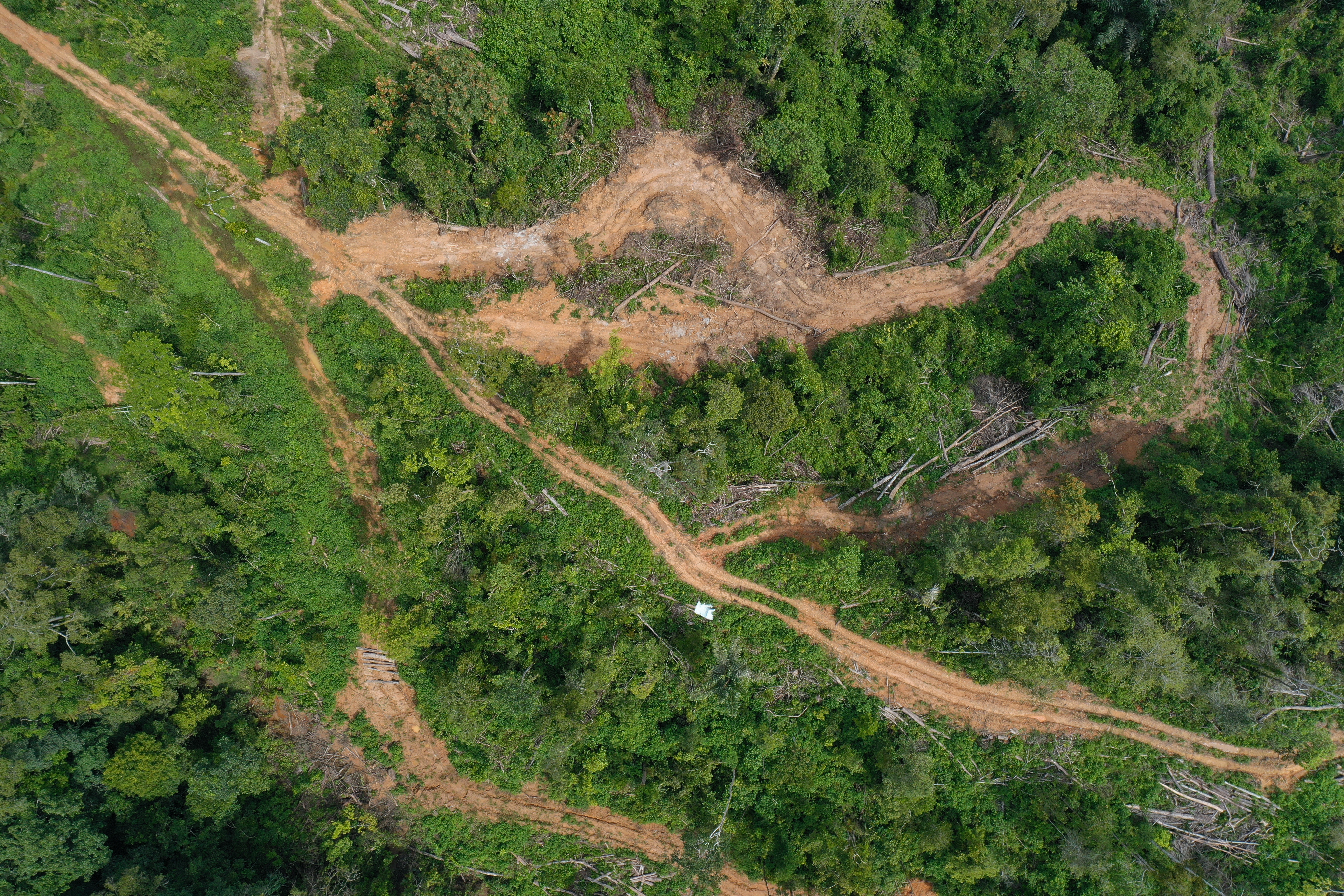
Beyond the impacts of this catastrophe, the Batang Toru Ecosystem faces mounting pressure from small-scale forest clearance, agricultural expansion, road and infrastructure development, mining activities and other land-use changes driven by growing demand for land and economic development. As forests become increasingly fragmented, orangutans lose access to critical food resources, breeding opportunities and movement corridors, leaving isolated populations more vulnerable to decline and extinction.
Detecting deforestation before it reaches one of the world's rarest apes
The challenge is spotting forest loss before it becomes permanent. Covering more than 2,400 km² of mountainous rainforest, Batang Toru is too large to monitor through field surveys alone. By the time a clearing is discovered on the ground, valuable habitat may already have been lost. High-resolution satellite imagery—captured at 30 cm resolution and donated by the Airbus Foundation—allows conservation teams to assess from space areas that would otherwise take weeks to survey in person, enabling faster action when habitat is under threat. Combined with existing remote-sensing tools, technical support and funding from the Connected Conservation Foundation, the project will establish a more responsive and effective forest monitoring system across Batang Toru.
- YEL will produce updated maps highlighting:
- Recent deforestation and fragmentation
- Drivers of habitat change
- Areas where connectivity is declining
- Priority areas for protection and restoration
These analyses will provide an updated baseline of forest condition across key areas of Batang Toru, helping conservation teams identify where intervention is most urgently needed.
"Batang Toru is an incredibly challenging landscape to monitor from the ground alone. The terrain is rugged, the forest is vast, and changes can occur rapidly and often unnoticed. With improved access to high-resolution satellite imagery through this support, our team will be able to identify emerging threats earlier and prioritise orangutan areas requiring urgent protection," - Julius Paolo Siregar, Head of the In-Situ Conservation Division, YEL
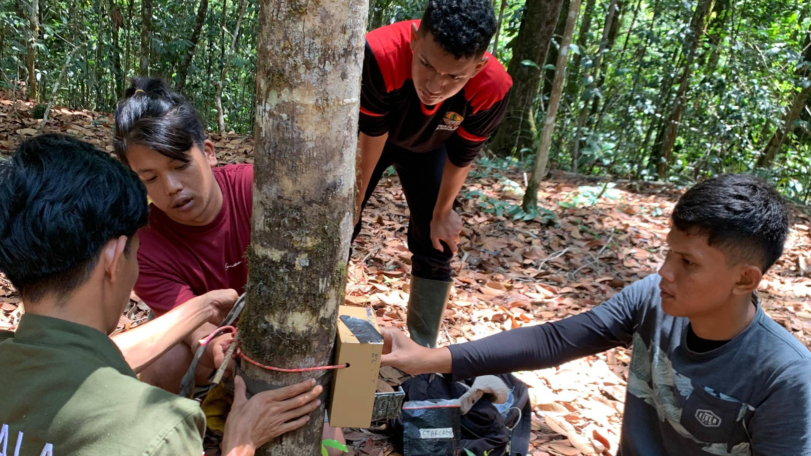
Integrating satellite monitoring with local knowledge
Local communities are often the first to notice forest clearing, road construction and other changes that satellites alone cannot explain. Combining community knowledge with field verification improves the accuracy of satellite analysis. Findings will guide habitat protection and restoration while contributing to a long-term database that supports forest management and coordination among conservation partners, government agencies and local authorities. With this approach, YEL is helping ensure that the world's rarest great ape continues to survive in the only place on Earth it calls home.