
Combining geospatial maps and indigenous knowledge for clouded leopard conservation
Partners: Fishing Cat Conservation Alliance, Small Wild Cat Conservation Foundation and Airbus Foundation
Key Species: Clouded leopard, Asiatic black bear, Asiatic Golden cat, marbled cat, leopard cat, masked palm civet, great Indian hornbill, spotted linsang
Key Ecosystems: Subtropical and montane forests
2026 Award Winner
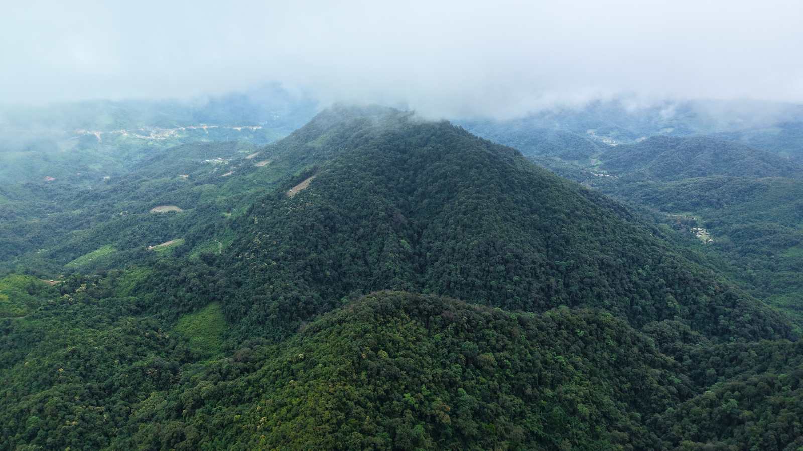
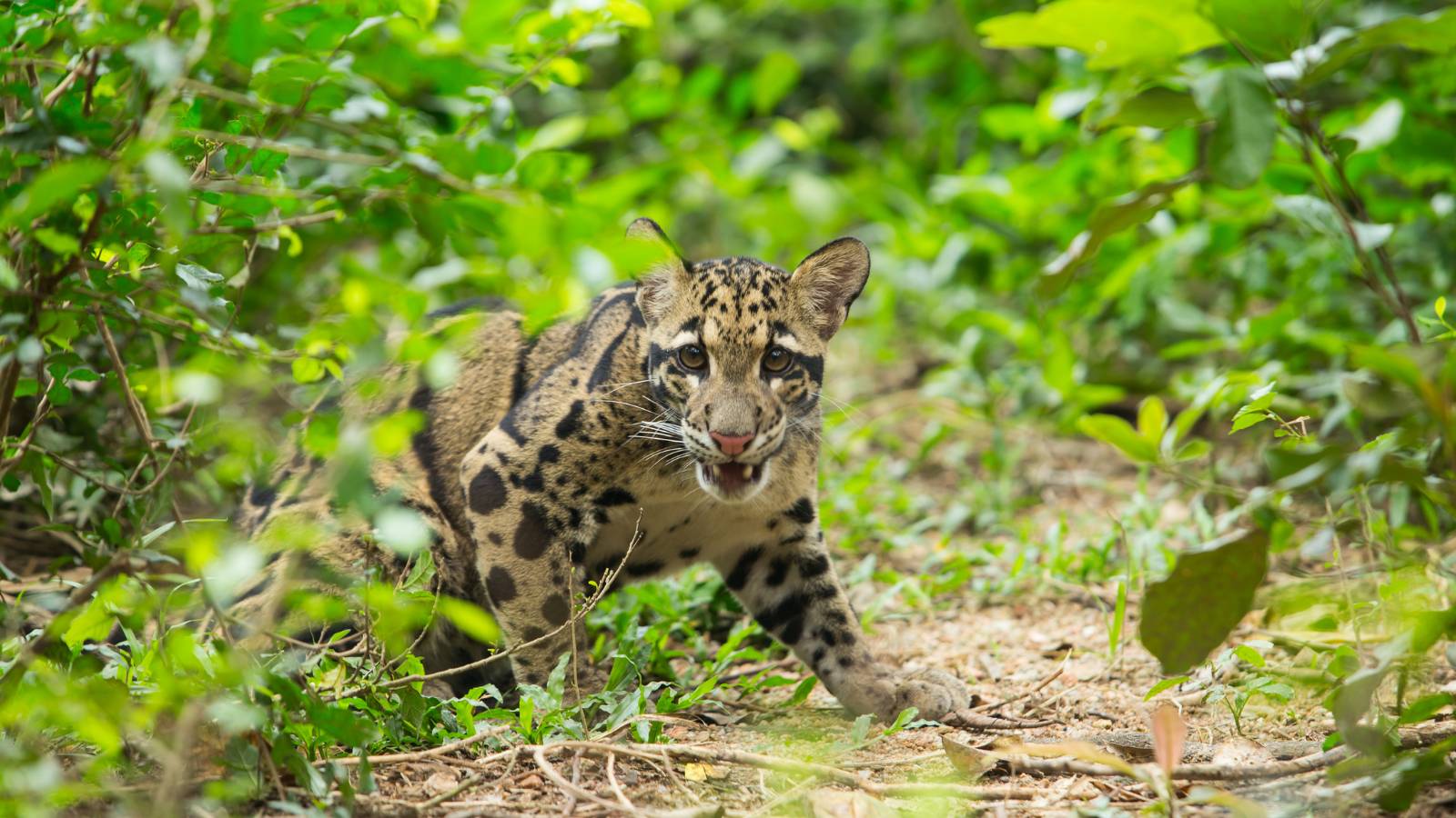
The clouded leopard is rarely photographed, seldom encountered and remains one of the least understood wild cats in the world. Across Northeast India, indigenous communities safeguard vast swathes of forest that provide refuge for this elusive species. Unlike many threatened animals whose survival depends on national parks, clouded leopards in Nagaland rely largely on forests managed by local communities under traditional governance systems.
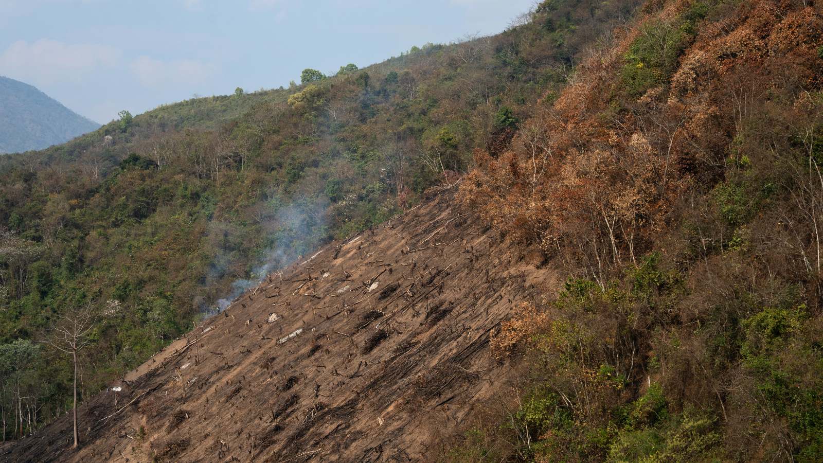
These community-conserved forests form part of a rich and interconnected landscape that supports bears, civets, hornbills and countless other species. The forests also provide water, food, forest resources and cultural value for communities that have stewarded them for generations. But these forests are changing. Road expansion, shifting cultivation, logging, hunting and wildlife snaring are gradually breaking up once-connected habitats. As forest corridors disappear, animals, including the clouded leopard, find it harder to move through the landscape in search of food, mates and safe territory, leaving populations increasingly isolated.
Combining science and community knowledge
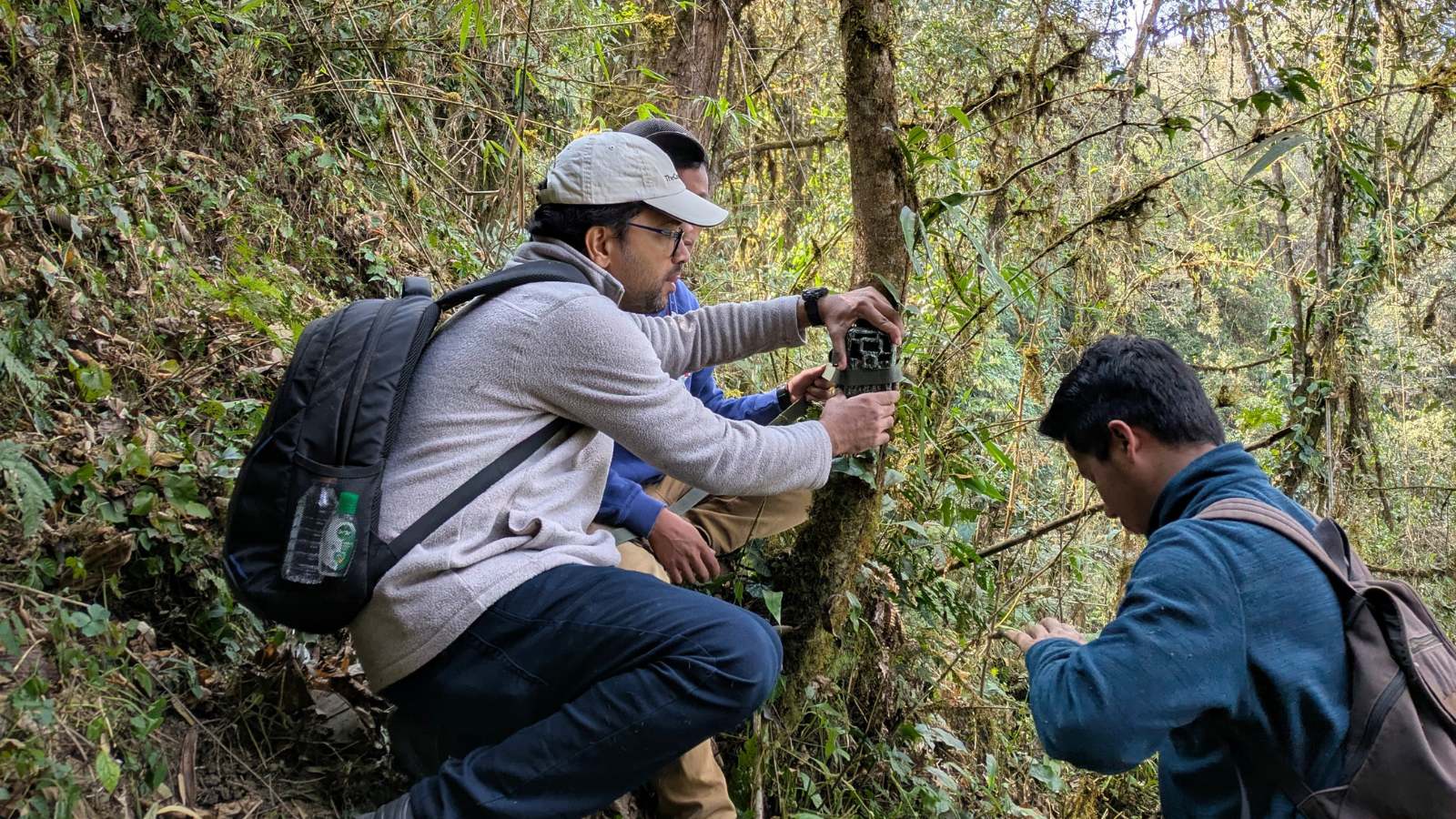
At the heart of this project is a partnership between the Fishing Cat Conservation Alliance and the communities that have stewarded Nagaland's forests for generations. Combining local knowledge with camera traps, field surveys and participatory mapping, communities and researchers will work side by side to identify key wildlife corridors, monitor wildlife and document threats, helping build a clearer picture of how clouded leopards and other species move through the landscape. Community members will also receive training in wildlife monitoring, mapping and land-use planning, helping ensure that conservation decisions remain firmly rooted in local leadership.
Following the hidden pathways of the clouded leopard
Surprisingly little is known about how clouded leopards move throughout Nagaland's forests. Which areas are most important? Which routes do they use? And where are the gaps that could cut wildlife populations off from one another?
To answer these questions, the Fishing Cat Conservation Alliance, through its Eastern Himalayan Marbled Cat Project and funding support from the Connected Conservation Foundation, will combine 30 cm high-resolution Pléiades satellite imagery from Airbus Foundation with camera traps, GPS surveys, and community mapping across approximately 59,661 hectares of Community Conserved Forests.
The project will create the first landscape-scale picture of clouded leopard connectivity in Nagaland, helping reveal:
- The routes clouded leopards use to move through the landscape
- Forest corridors at risk of becoming disconnected
- Areas affected by hunting, logging and land-use change
- Priority locations for protection, restoration and long-term monitoring
The resulting maps and analyses will support the development of long-term management plans that strengthen community-led conservation.
"For clouded leopards, connected forests are essential for survival. By combining high-resolution satellite imagery with community-led monitoring and local ecological knowledge, this project will help us identify and protect the habitats and corridors that sustain wildlife across Nagaland’s community-conserved landscapes," - Giridhar Malla, Founder, Eastern Himalayan Marbled Cat project.