Fourth Satellites For Biodiversity Award Launches, Enabling Precision Conservation With VHR Satellite Imagery And GEOAI
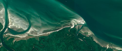
The Satellites for Biodiversity Award opens its fourth call, helping conservationists apply cutting-edge geospatial tools, including very high-resolution (VHR) satellite imagery, artificial intelligence (AI) and in-situ data to reveal critical details of our changing planet.
Published 29 September 2025
The combination of geospatial data and artificial intelligence is part of a rapidly growing field known as GeoAI, which is crucial for environmental decision-making, as well as informing global targets, policies and actions.
Accuracy has been a major challenge for the application of early mapping algorithms to lower-resolution imagery, where, in some situations, outputs have resulted in skewed assessments, misguided priorities, and wasted efforts. With advances in computing, AI Foundation Models, training strategies, and collaboration, a more comprehensive toolbox for mapping and monitoring the planet is emerging.
HR Satellite imagery + AI + In Situ Data: New Accuracy and Precision for Conservation
The award, run by the Connected Conservation Foundation (CCF) and Airbus Foundation, enables projects to test and apply these advances, granting access to Airbus’s VHR imagery, which, when paired with GeoAI and local field data, can allow practitioners to:
- Build high-quality training datasets and strategies, improving the accuracy of AI models to work on a range of high and low-resolution images
- Map natural habitats and biodiversity at a fine scale, detecting new features vital for more precise classification
- Monitoring more precise land-use change and threats at scale
- Inform actionable strategies, such as conflict hotspot mapping, degradation mitigation and restoration to stop the loss of vulnerable ecosystems and species
Award open for global applications
The award invites proposals from individuals and non-profits. Three winners receive:
- Access to Pléiades and Pléiades Neo satellite data, including HD15
- $6,000 in funding
- Complimentary ArcGIS Pro from ESRI for advanced mapping and analysis
- Ongoing mentorship and technical support from CCF and Airbus geospatial experts
- Work showcased globally via publication in the Ecosystem Insight Hub
Proven impact across Ethiopia and South Sudan
Past winners show how advanced Earth observation and community insight drive conservation breakthroughs. In Ethiopia’s Bale Mountains, Chulalongkorn University and the Ethiopian Biodiversity Institute used these technologies to reveal a tenfold rise in human settlements and a 42% expansion of farmland within just five years, threatening the survival of the world’s last 500 Ethiopian wolves. Using Pléiades Neo imagery with AI mapping and community workshops, the project delivered vital evidence for policymakers and enabled local communities to integrate traditional knowledge and co-develop and apply human-wildlife coexistence strategies.
“This generous support has transformed our ability to protect Ethiopian wolves by mapping habitat loss and providing vital insights,” says Yacob T. Tesfaldet, Environmental Data Scientist and Researcher from Chulalongkorn University. “Satellite technology gives communities the evidence they need to act now.”
In South Sudan, Fauna & Flora used 50 cm imagery and AI land cover mapping to classify habitats in Bangangai and Bire Kpatuos reserves, revealing key corridors and areas under threat. The maps, the first of their kind, now guide patrols, community engagement and targeted conservation actions to support community-managed buffer zones around the park.
Driving a new era of GeoAI-powered conservation
“I’m inspired to see how applicants integrate these cutting-edge tools with traditional knowledge of local communities to define and implement effective strategies for conservation,” says Sophie Maxwell, Executive Director of CCF.
“This award is designed to boost the capabilities available to conservationists and local communities,” adds Hania Tabet, Head of Social Value and Airbus Foundation Director. “By pairing our advanced satellite imagery with their on-the-ground knowledge, we’re giving them the precise tools and clear evidence they need to protect vulnerable ecosystems and species, driving real, tangible impact.”
Applications close Friday, 19 December 2025.
Full grant details and application form available at: https://connectedconservation.foundation/satellite-awards/
Ecosystem Insight Hub published projects accessed at: https://connectedconservation.foundation/ecosystem-insights-hub/

ENDS
NOTES TO EDITORS:
About Airbus Foundation
The Airbus Foundation provides access to Airbus’ unique portfolio of high-tech products, services and know-how to help address some of the world’s most pressing problems, developing impactful partnerships with NGOs and associations around the world to deliver its missions.
About Connected Conservation Foundation (CCF)
CCF unites the capabilities of technology companies to equip local partners with game-changing tools for nature protection and restoration. We help facilitate essential landscape-scale satellite monitoring and on-the-ground sensing solutions, including digital infrastructure, connectivity, communications and sensing devices, enabling conservation managers and local communities to pre-empt and stop poaching, habitat loss and human-wildlife conflict, to build resilient ecosystems and communities.
About Esri
Esri was founded on the vision that geographic thinking and digital mapping could help design a better world. To this day, we remain passionately true to that vision, working closely with charities, government and commercial organisations across the world, to help them sustainably improve the lives of citizens, realise the potential of their communities and protect and nurture the environment for future generations. Our technology, ArcGIS and services make sense of complexity and model the world from a geographic perspective that recognises the importance of place in improving people’s lives.


