ETHIOPIA, PLÉIADES NEO © AIRBUS DS (2022)
APPLICATIONS ARE NOW CLOSED. We look forward to announcing the winners in March 2025.
We're thrilled to announce our award's third round (R3), in collaboration with the Airbus Foundation.
We invite individuals and not-for-profit organisations to submit proposals that use high-resolution (HR) satellite data, combined with the power of machine learning, to monitor and protect the Earth’s vulnerable creatures, habitats and environments.
- Access to Airbus’s Pléiades and Pléiades Neo (15*, 30 and 50cm) satellite imagery
- $6,000 in funding and ongoing technical support
- ArcGIS Pro from ESRI
If you only need satellite imagery and no funding, please still apply. Further awards of satellite imagery are available beyond the three winners.
Closing date: Wednesday 18 December 2024
(C) African Parks
Are you or your team using remote sensing to monitor ecosystem dynamics? Are you exploring innovative or proven ways to leverage the latest satellite technology, integrate data from ground sensors or use machine learning? If so, we want to hear from you.
NB: the use of machine learning is not mandatory to apply
We are inviting proposals across the following use cases:
State of Species
Projects focusing on the state of species abundance, distribution and extinction risks in relation to threats from environmental, social or commercial pressures. These projects assess threat level (IUCN Red List threat level), population sizes and extinction drivers including, changes in habitat area and quality.
We recommend applicants monitor species across homogenous landscapes and seascapes - where the objects of interest have a strong contrast to stand out within their background environment.
Invasive Species
Projects investigating the introduction, spread and management of invasive plant or animal species.
Ecosystem Management
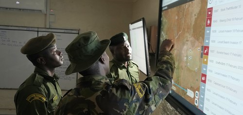
Projects that track and inform management practices and operations, especially within or near biodiversity-sensitive areas. Including early-warning solutions that enable response to mitigate conservation issues.
Ecosystem Connectivity
Projects examining changes to “spatial configuration,” “structural connectivity,” and “functionality connectivity” - focusing on maintaining or enhancing the physical, biological and ecological linkages within and between ecosystems.
Ecosystem Conversion and Restoration
Projects identifying and analysing the change in natural spaces to managed systems or built-up areas, as well as efforts to restore areas to their natural state.
Our Satellites for Biodiversity Award is now open. To get started, complete our lightweight application here. Applications close at 23.59 on Wednesday 18 December 2024. Participants may be asked to provide further details regarding their submissions via a phone call or email.
We encourage broad participation and applications from global not-for-profit organisations or individuals who:
Please read our following terms and conditions before applying to the Satellites for Biodiversity Conservation Grant. You can view them here. By submitting an entry for consideration, the submitting individual or organisation agrees to the following Terms and Conditions.
(C) African Parks
(C) African Parks
By combining conservation expertise with our access to cutting-edge satellite products and services, we can support conservation projects with greater precision and impact.
Hania Tabet, Airbus Head of Social Value & Airbus Foundation Director
Join the thousands of people like you who have stepped up to support our critical conservation work around the world.