



Satellite-based mapping and management of invasive species to support one-horned rhinos in Nepal
Authors | Jake Williams, Henry Häkkinen, Nathalie Pettorelli (ZSL Institute of Zoology)
- Ecosystem management
- Invasive species
- The Chitwan–Parsa Complex is a key refuge for the endangered greater one-horned rhinoceros, supporting almost all of Nepal’s rhino population, making high-quality grassland habitat critical to the species’ survival. However, these Terai grasslands are increasingly threatened by invasive alien plant species such as Mikania micrantha, which can outcompete native forage species and reduce habitat quality for rhinos and other large herbivores.
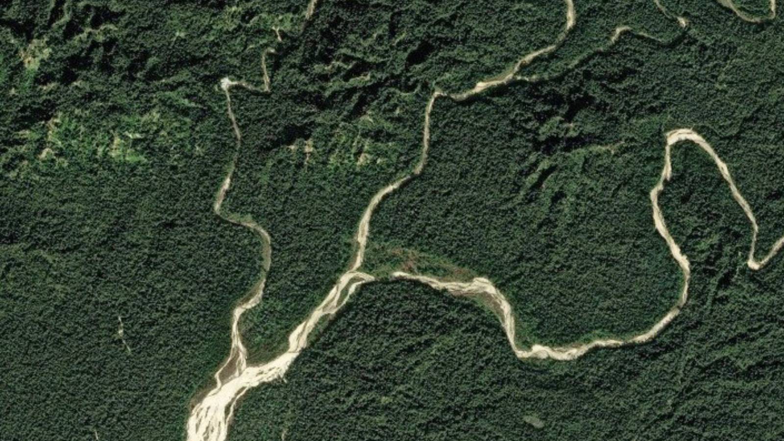
- Very-high-resolution (30 cm) satellite imagery (Pleiades Neo) was used to map Mikania micrantha with ~82.7% accuracy, revealing widespread but not increasing presence of the invasive plant (~37% of grassland area, compared to ~44% a decade ago).
- Patterns of Mikania prevalence varied by management type, with higher levels in mowed and mechanically cleared grasslands and lower levels in burned areas, suggesting management may influence invasion dynamics.
- The project produced spatial maps of Mikania presence and evidence on the effectiveness of habitat management options.
- The study demonstrates the value of combining very high-resolution satellite remote sensing with field and management data to better understand how different management practices shape invasive species distributions, providing conservation managers with evidence to target interventions more effectively and safeguard critical rhino habitat, supporting evidence-based conservation decisions.
Objectives
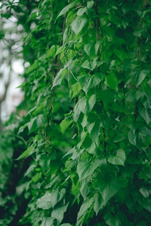
1. Map invasive alien plant species (Mikania micrantha) using very high-resolution satellite imagery.
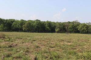
2. Evaluate the effect of habitat management (e.g., mowing, controlled burning, natural megaherbivore grazing) and rhinos on the spread of invasive alien plant species.
3. Provide new evidence to Nepal’s Department of National Parks and Wildlife Conservation to support grassland management in the Chitwan-Parsa Complex.
Introduction
The Chitwan–Parsa Complex in lowland Nepal is a globally significant conservation landscape and hosts almost all of Nepal’s greater one-horned rhinos (Rhinoceros unicornis) - 697 out of 752 according to the latest census (2021) - as well as important populations of Bengal tigers (Panthera tigris tigris) and Asian elephants (Elephas maximus). It also supports an ungulate assemblage of at least ten species, including red muntjac (Muntiacus muntjac), spotted deer (Axis axis), wild pig (Sus scrofa), sambar (Rusa unicolor), gaur (Bos gaurus), and nilgai (Boselaphus tragocamelus). Around 350,000 people live in the surrounding buffer zone, with livelihoods closely tied to the landscape through tourism revenues and community forestry programmes (NSO 2022).
Despite its conservation importance, the region faces multiple interacting threats, including agricultural encroachment, livestock grazing, infrastructure development, poaching and the spread of invasive alien plant species. Among these, invasive alien plants are emerging as one of the most serious threats to the ecological integrity of Chitwan–Parsa’s floodplain grasslands. Species such as Mikania micrantha and Lantana camara can rapidly dominate native vegetation, reducing forage availability, altering habitat structure and potentially degrading critical habitat for rhinos, deer and other grassland-dependent wildlife. Their spread threatens to undermine decades of conservation investment and the long-term viability of Nepal’s flagship megafauna populations.
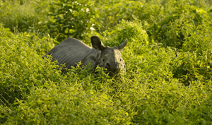
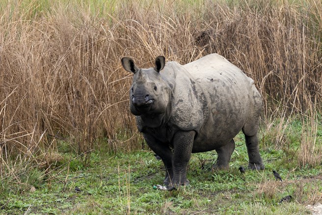 Figure 1: One-horned rhino © Martijn Vonk
Within protected areas, dynamic grasslands are actively managed to maintain suitable structure and forage quality for rhinos and associated megafauna. Considerable resources are invested annually in interventions such as burning, mowing, uprooting, or combinations of these approaches, although some areas remain unmanaged, particularly near settlements and water sources. However, despite substantial expenditure on habitat management, there is limited empirical evidence on which interventions are most effective at maintaining native grassland conditions and preventing invasive plant expansion. Emerging concerns suggest that mechanical mowing may inadvertently facilitate the spread of invasive alien plants, potentially compromising long-term habitat quality.
At the same time, growing evidence points to complex feedbacks between grassland dynamics and large herbivores, suggesting that megaherbivores may influence vegetation structure and invasion processes. However, the extent to which species such as the greater one-horned rhinoceros contribute to regulating habitat condition or suppressing invasive plant spread remains poorly understood, particularly in South Asian floodplain ecosystems.
Addressing invasive plant encroachment is therefore a critical conservation priority. Yet managers currently lack the evidence needed to determine where and how to deploy limited resources for maximum ecological benefit. This project sought to address these knowledge gaps by integrating high-resolution satellite remote sensing with spatial ecological modelling to quantify how invasive plants respond to alternative management interventions.
Study Area
The Chitwan–Parsa complex spans 1,579 km² across two protected areas: Chitwan National Park (952 km²) and Parsa National Park (627 km²). It lies within the eastern section of the transboundary Terai Arc Landscape (TAL), which extends across northern India and southern Nepal.
Chitwan National Park, established in 1973, is Nepal’s oldest national park. Parsa was initially designated as a Wildlife Reserve in 1984 and was later upgraded to National Park status in 2017.
The floodplains of the East Rapti and Narayani rivers support extensive Terai grasslands, characterised by tall grass species such as Saccharum narenga, Phragmites karka, Saccharum spontaneum, and Imperata cylindrica, which can reach heights of 2–7 m.
These grassland ecosystems are increasingly threatened by invasion from Mikania micrantha. In response, a range of management strategies is employed, including mowing, burning, combined mowing and burning, and post-mowing stump removal. However, management is spatially variable, with some areas remaining unmanaged—particularly near human settlements and wildlife water sources, potentially influencing invasion dynamics.
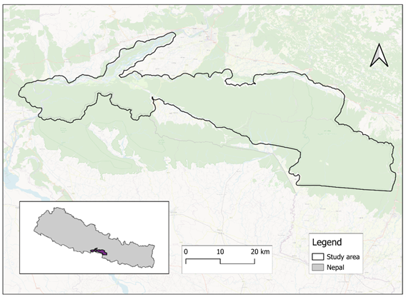 Figure 2: Study area showing the Chitwan complex. Inset shows the study area in Southern Nepal.
Methodology
Data
VHR satellite imagery
ZSL utilised satellite imagery from the Airbus Pleiades Neo constellation at a resolution of 30 cm. Nineteen scenes covering the entire study area, captured between May and November 2024, were processed in Google Earth Engine through histogram matching to enhance contrast. Several vegetation indices were computed, including Normalised Difference Vegetation Index (NDVI), Soil Adjusted Vegetation Index (SAVI), Enhanced Vegetation Index (EVI) and Normalised Difference Water Index (NDWI). Image texture features were extracted from the resulting 10 bands, consisting of six image bands and four indices. All the bands were merged to form an image mosaic ready for analysis.
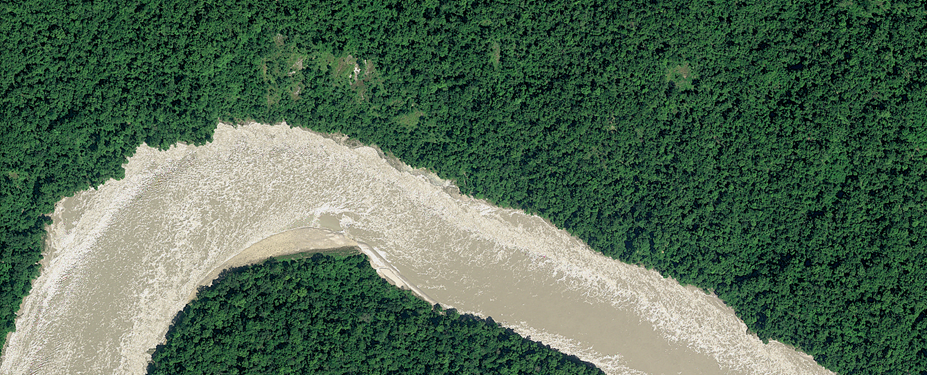
Figure 3: Example of 30 cm satellite imagery of Nepal, Pleiades Neo © 2024 Distribution Airbus DS
Field data
Field surveys were conducted in May and October 2024, coinciding with the period when satellite imagery was captured. During the field activity, 138 stratified random points were selected across grasslands in the Chitwan–Parsa complex to record the presence of the invasive species Mikania and Parthenium. At each point, GPS coordinates, photos, land cover within a 10-meter radius, and visible management practices were documented. Data on grassland management were compiled from National Park authorities (2022) and a Chitwan grassland mapping report (2016), which were harmonised into a single geospatial dataset by reconciling inconsistencies in management unit boundaries.
Analysis
Satellite image classification
A Random Forest model was used to classify the image into two classes: ‘Mikania’ and ‘No Mikania’, with the data split into training (70%) and validation sets (30%). Model hyperparameters were tuned using a grid search method over the training set. The model’s performance was evaluated using standard metrics.
Statistical analysis
After image classification, a bootstrapping approach was applied, drawing 10,000 pixels per sample and repeating the process 1,000 times. Mikania presence was modelled using a generalised mixed-effect model, with management actions (mown, burned, uprooted, or combinations) and location (Chitwan vs. Parsa as a proxy for rhino presence) as fixed effects and area ID as a random effect. Model diagnostics confirmed a good fit, and final parameter estimates, along with 95% confidence intervals, were derived from aggregated bootstrap outputs, reported on both the logit and response scales.
Results
Random Forest classification
Random Forest classification of Mikania presence across the Chitwan–Parsa complex achieved ~83% accuracy.
|
ML Model |
Producer’s accuracy (%) |
User’s accuracy (%) |
F1 (%) |
| Mikania presence |
86.2 |
83.3 |
84.8 |
| Mikania absence |
78.3 |
81.8 |
80 |
Table 1 from Williams et al., 2026: Producer’s, user’s accuracies and F1 scores for the classification of Mikania presence throughout the grasslands of the Chitwan-Parsa complex
Prevalence varied substantially by area and by management approach: Mikania occupied 43.3% of the sites investigated in Parsa and 37% of those in Chitwan; it covered 42.6% of all mowed sites, 30.1% of all burned sites, 49.6% of all mowed and burned sites, 57.2% of all mowed and uprooted sites, and 41.2% of unmanaged sites.
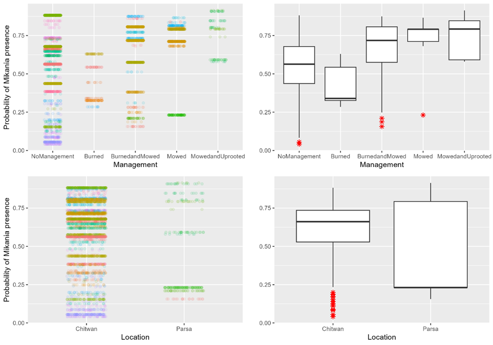 Figure 4: Model-predicted probability of Mikania presence by management approach and location. Left panels show individual predictions across sites (coloured by site ID) within the Chitwan-Parsa complex, while right panels summarise these as boxplots.
Our models found that sites which were mowed or mowed and uprooted were – on average – more likely to be invaded by Mikania. They also found that Mikania was less common in Parsa (with very few rhinos) than in Chitwan (a major rhino stronghold). However, this difference may be partly due to mowing and uprooting practices that are specific to Parsa. Differences between individual grassland patches also explained a lot of the variation, suggesting that local conditions strongly affect how much Mikania spreads.
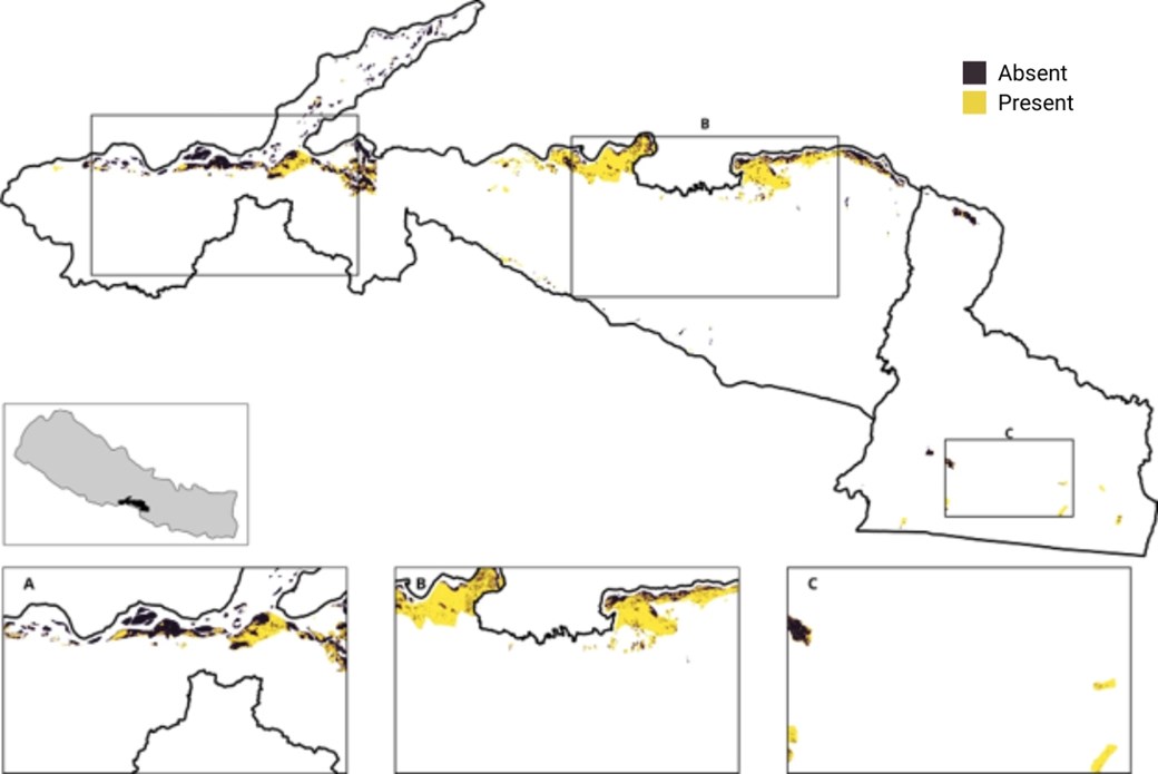 Figure 5: From Williams et al., 2026: Mikania micrantha invasion mapped for known grasslands in the Chitwan-Parsa complex. Grasslands are under different forms of management, including no management. Yellow areas indicate patches of grasslands where Mikania is present, while purple areas indicate where Mikania is absent.
Conclusion and next steps
This study demonstrates how very-high-resolution satellite imagery can accurately map Mikania micrantha and reveal its widespread presence across the Terai grasslands of the Chitwan–Parsa complex. Comparison with earlier ground-based estimates suggests that Mikania cover has remained relatively stable over the past decade, at around 40–44%.
The research also found that Mikania distribution varies in relation to management practices. Grasslands managed solely through mowing showed a higher presence of Mikania, while areas managed using burning, either alone or in combination with mowing, showed lower levels of invasion. These findings suggest that management approaches may influence Mikania distribution and highlight the need to better understand how different interventions affect both invasive species and native grassland recovery.
However, while the results are suggestive, they do not provide sufficiently strong evidence to make clear management recommendations. Management interventions are likely to interact with a range of other factors, including herbivore pressure, flooding and local environmental conditions, and the observational nature of this study limits our ability to determine precisely which factors are driving the patterns observed.
The findings therefore highlight the need for further research, particularly controlled, on-the-ground experiments, to establish robust evidence about which management techniques are most effective at reducing Mikania spread and whether some approaches may inadvertently promote its persistence or expansion. Such experiments will be highly valuable in guiding future invasive species management, both within the Chitwan–Parsa complex and in similar grassland ecosystems.
This work is ongoing, and the findings will contribute to continued efforts to strengthen evidence-based conservation and invasive species management in Nepal. ZSL Nepal, with co-authors Dr Dinesh Neupane and Dr Bhagawan Raj Dahal, continues to contribute to the Department of National Parks and Wildlife Conservation's (DNPWC) technical committee, advising on evidence-based conservation and supporting the development of future research and management approaches.
ZSL
An international conservation charity driven by science, working to restore wildlife in the UK and around the world. Become a supporter today.